Iridium Constellation for Mission Critical Asset Satellite Tracking
Satellite tracking resolves issues with GPS vehicle tracking in remote areas. Not all fleets operate in urban areas or cellular coverage areas. Certain industries such as oil and gas operate extensive in very remote areas. GPS satellite tracking is needed for productivity but also for safety. The GO System offers both a cellular tracking system and a satellite tracking option. Learn more about Iridium.
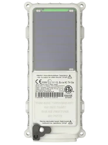
Solar Satellite Tracking
The SmartOne Solar provides a robust and rugged device with an extremely long field life. With no added labor costs to change batteries, find assets if the batteries die and solar recharging, the total cost of ownership for this solar GPS tracker makes a lot of long-term sense. When assets are traveling the globe or being used in very remote locations, dealing with replacing batteries can quickly cost more in labor and travel than the cost of the GPS tracker. The SmartOne Solar eliminates the unforeseen costs down the road.
Configuration Profiles
- Standard Messaging
- Reduced Messaging
- Theft Messaging
Key Features SmartOne Solar
- Solar-powered
- Up to 10-year field life
- Intrinsically Safe
- IP-67
- Bluetooth interface for configuration and firmware updating
- Wide range of reporting capabilities including;
- GPS Location reporting in 4 modes
- Geofencing with configurable range setting
- Stationary or in-motion reporting
- Reduced messaging & theft recovery modes
- Receives and transmits data from external sensors
- Two dry contact or wetted-voltage inputs available to manage engine run time, tank level or various alarm inputs
- Quick and easy installation requires no harnesses, external power or external antennas
Specifications
DIMENSIONS
- 3.25 IN (H) X 7 IN (W) X 1.125 IN (D)
- 8.26 CM (H) X 17.78 CM (W) X 2.86 CM (D)
WEIGHT
- 13.5 oz/385 g
- With optional mounting bracket 40.57 oz. (1150 g)
OPERATING TEMPERATURE
- -40? to +85? C
INPUT VOLTAGE
- 10 TO 48 VDC
BATTERY TYPE
- Built-in rechargeable NiMH batteries (non-replaceable)
CERTIFICATIONS & STANDARDS
- FCC, ISED, CE, AUS/NZ, ANATEL, INMETRO CERTIFICATE â???? LMP 19.0127 X
- PENDING: JQA(JAPAN), IFT, INDONESIA
- ATEX/IECEx II 1 G,Ex ia IIC T4 Ga For international Zone 0 applications, HERO
- North America cETLus:
â???? Class I, Division 1, Groups A-D, T4. â???? Class I, Zone 0, AEx ia IIC T4 Ga - WEEE Compliant
- GMPCS-MoU
- IP68/69K, MIL-STD-810G for: Immersion, Impact resistance, Salt Fog, Acidic Atmosphere, Humidity Vibration
Includes
- 12 different reporting times
- Interval or 24-hour operation mode
- Alternate reporting schedules
- Low battery message
- Motion Sensor/Vibration parameter and scheduling
- Contact closure parameters
- Diagnostic messages
- Include Speed and Heading data in reported motion messages
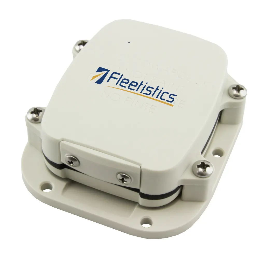
AT-5500c Battery Asset Tracker
The AT-5500c is a compact, affordable, and rugged asset tracker. The AT-5500c operates on 4 AAA Lithium-ion batteries which can be purchased from most retail locations. Download pdf
Key Features AT-5500c
- Up to 12 different reporting times
- Interval or 24-hour operation mode
- Alternate reporting schedules
- Low battery message
- Quick installation
- Operates on external line power, regulator cable or lithium batteries (no need to purchase expensive proprietary replacement batteries)
- Automatic alerts if asset moves outside of predetermined range
- Messaging cost-reduction mode for when asset remains in same location for a predetermined period of time
- Hardware on/off feature: Allows the unit to initiate GPS re-centering functionality
- Serial signals (TTL) accepted from external device sensors
- Satellite technology: Global LEO Satellite operation using the Globalstar Simplex Data Network
Specifications
- DIMENSIONS
- 2.7 x 3.25 x 1in (6.86 x 8.26 x 2.54cm) with brackets
- WEIGHT
- 3.6 oz (102g) with 4 batteries and mounting hardware
- OPERATING TEMPERATURE
- -22 to 140?F (-30 to 60?C)
- NOTE: The unit shall remain operational over the -40 to 185?F (-40 to 85?C) range, though may experience battery life and RF signal degradation.
- LINE POWER
- 5V DC or 8-22V DC with regulator cable
- BATTERY TYPE
- 4 AAA 1.5V lithium (provides 1.5+ years of life)
- CERTIFICATIONS: ANATEL Certification for Brazil (pending), FCC CFR Parts 15 and 25, Industry Canada, CE Mark (European Certification) and COFETEL
- STANDARDS: SAE J1455 MIL STD 810, NEMA 4X/IP68, RoHS Compliant
- SATELLITE TECHNOLOGY: Global LEO Satellite operation using the Globalstar Simplex Data Network
GlobalStar Satellite Tracking Configuration Options
Standard Messaging
In Standard Messaging Mode, the SmartOne satellite tracking device reports its position at regular time intervals that are programmed during the configuration process. Standard Messaging Mode can also be configured to utilize the SmartOne’s internal motion/vibration sensor. If enabled, the SmartOne will transmit its position at independently configured regular time intervals when the device is In Motion.Location messages can be programmed to be constant (Interval Messaging) or the device may be configured to use up to 12 different intervals in sequence (Time(s) of Day Messaging). Message intervals can be programmed in one-minute intervals from 35 minutes up to 45 days.
Example of Message Interval: The SmartOne is configured to report once every 24 hours whennot In Motion and every two hours when In Motion. If the SmartOne went into motion at any time of day the Message Interval while In Motion would be every two hours beginning when the SmartOne started moving.
Example of Message-Time(s) of Day: The SmartOne is configured with a message time of dayof 9:00 AM, a second message time of day of 12:00 noon, a third message time of day of 8:00PM and once per hour when In Motion. The SmartOne would transmit three messages a day at the same configured times every day. If the SmartOne went In Motion it would transmit its location message every hour.
SmartOne Solar User Guide v1.2.1 Confidential & Proprietary Information Usage Example: A Company is required to report the GPS locations of their hazardous chemical containers twice a day. Based on this requirement, the Company has two options: set a message interval of every 12 hours, the 12 hour internal begins when the device is powered up or when the configure message times of day are 12:00 noon and 12:00 midnight
Reduced Messaging
SmartOne Solar Satellite Tracking User Guide v1.2.1Confidential & Proprietary Information Usage Example: A Company is required to report the GPS locations of their hazardous chemical containers twice a day. Based on this requirement, the Company has two options: set a message interval of every 12 hours, the 12 hour internal begins when the device is powered up or when the configure message times of day are 12:00 noon and 12:00 midnight.Reduced Messaging Reduced Messaging Mode reduces the cost associated with transmitting messages over Globalstar’s satellite network by sending messages at a minimal message interval when the asset is in a defined area and transmits at a higher message interval when the asset is changing locations. These message intervals are set as part of the configuration process based on the concept that repeated reporting information of the same location, when an asset has not moved from its defined area, is redundant and doesn’t provide addition usable information about its current location. By comparing current and prior position information, the SmartOne determines if its location is changing. The definable area in which the device should remain in Reduced Messaging Mode is called the Change of Location Area and it is a square. When the SmartOne goes outside of the square, its location is considered to be changing or relocating.
Usage Example: A fleet operator owns 1,000 trailers. When the trailer(s) are sitting at a depot they want a location message once a day. They also want a message notification within one hour when a trailer has left a depot. Lastly, they want a location message every three hours when a trailer is moving between depots. Based on this requirement, the fleet operator will need to set the Change of Location Area (size of the depots where the trailers will visit), the message interval while the trailers are inside the Change of Location Area (one per day), the interval at which the SmartOne will check its location while in a State of Vibration and inside the Change of Location Area(one per hour), set the number of messages when the trailer leaves the Change of Location Area (one Change of Location Area Alert Message) and the message interval while the trailers are in transit between depots (every three hours).
Theft Recovery
When the SmartOne is configured to operate in the Theft Recovery Mode, it differentiates between authorized and unauthorized movement of an asset. While the power to the SmartOne is turned off, all movement of the asset is considered authorized. When power is turned on, the SmartOne obtains a position from GPS satellites. The position is used to set the center of the defined Change of Location Area in Theft Alert Mode. While in the Change of Location Area, the SmartOne obtains position fixes at an interval set during configuration. If the SmartOne remains within the Change of Location Area, all movement is considered to be authorized.
Once the SmartOne’s position is outside of the Change of Location Area, it alerts the SmartOne to an unauthorized movement and immediately sends a location message (Change of Location Alert Message). The SmartOne continues to send location messages at a message interval set during the configuration process until the power is turned off or the battery is dead. Usage
Example: A construction company is working on a job site for one year and wants to ensure that their generators and other heavy equipment on site aren’t stolen. The company wants to check the location of their equipment 12 times a day, every 2 hours, to confirm the asset hasn’t been stolen, but only wants a transmitted location message once per day. Based on this requirement, the construction company will need to set the Change of Location Area (size of the job site), the message interval while inside the Change of Location Area (one per day), the interval at which the SmartOnewill check its location while in a State of Vibration and within the Change of Location Area (every twohours) and the message interval if the asset is outside the Change of Location Area.

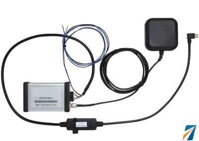
GO Satellite GPS Tracker by Geotab
Satellite tracking for remote areas
Geotab GPS Tracker
Modular by Design
Sticking with the modular design of the Geotab System, the GO Satellite tracker can be added to a standard GPS tracker and used on specific vehicles. This provides customers with the flexibility to have GPS tracking in remote areas without having to invest in a more expensive base platform. The GO system automatically fails over to the cellular network when in cell coverage to keep costs as low as possible. When utilizing satellite tracking, the device reduces data transmission to avoid costly satellite communication charges.
Essential Data
Location History


