Fleet Preparation for Hurricanes
Fleet preparation for hurricanes and other natural disasters is a necessary step in general fleet management. Your GPS system is an invaluable tool in this preparation. From vehicle and equipment locations to current fuel levels, your GPS system provides the tools necessary to prep for the hurricane as well as the tools necessary to manage in the aftermath.
Fuel Availability
The first step in Fleet preparation for hurricanes hurricane is to ensure the availability of fuel. In the aftermath of a hurricane or large tropical storm, rarely do fueling stations have the power necessary to pump fuel from storage tanks. Prior to the hurricane, make sure all vehicle and storage fuel tanks are full.
If your organization maintains a local fuel supply, top off your vehicles at local gas stations to preserve locally stored fuel for after the hurricane. After a hurricane, the issue isn’t a lack of available fuel, it’s the inability to pump the fuel due to lack of electrical power. Most GPS systems report fuel levels of vehicles. This feature simplifies determining the vehicles that need fueling as well as the ability to monitor fuel levels in remote vehicles.
Missed Business Opportunities
If your business is one that will be in high demand after a hurricane, you should plan to capitalize on the situation as quickly as possible. To be ready you need three things in place. Inventory, people and systems.
Determine what items are going to be in high demand and stage them at a safe location. Competitors who do not do this will not be able to get inventory for days or weeks and your business can thrive. People must be ready to return to work. Knowing who will be available will determine how much post hurricane work you can get done.
Last is business systems must be in the cloud so they can be accessed from home or from any computer based on where Internet and power is available. Fleetistics uses Microsoft 365 from IGTech365 so employees can work from anywhere, anytime, with an Internet connection. Files are backup to the cloud using Azure and servers are virtual or co-located to avoid flood damage.

Fleet Preparation for Hurricanes -Staging Location
The next step in fleet preparation for hurricanes is to stage your fleet location. Make sure vehicles are protected from wind and water as much as possible. The primary danger to vehicles from the wind is falling trees or power lines. Hurricane force winds may not be high enough to affect the vehicle directly, but even a category one hurricane has winds high enough to take down power lines and trees.
Power lines can take a vehicle out of service by blocking the vehicle’s path or by falling on the vehicle. After a hurricane, downed power lines are a danger because many times they are live. Falling trees are directly responsible for more damage to vehicles than wind. Stage your fleet in a location that mitigates the effects of downed power lines and falling trees as much as possible. Your GPS system provides the tools necessary to monitor your vehicles whether the staging area is at your location or a more secure remote location.

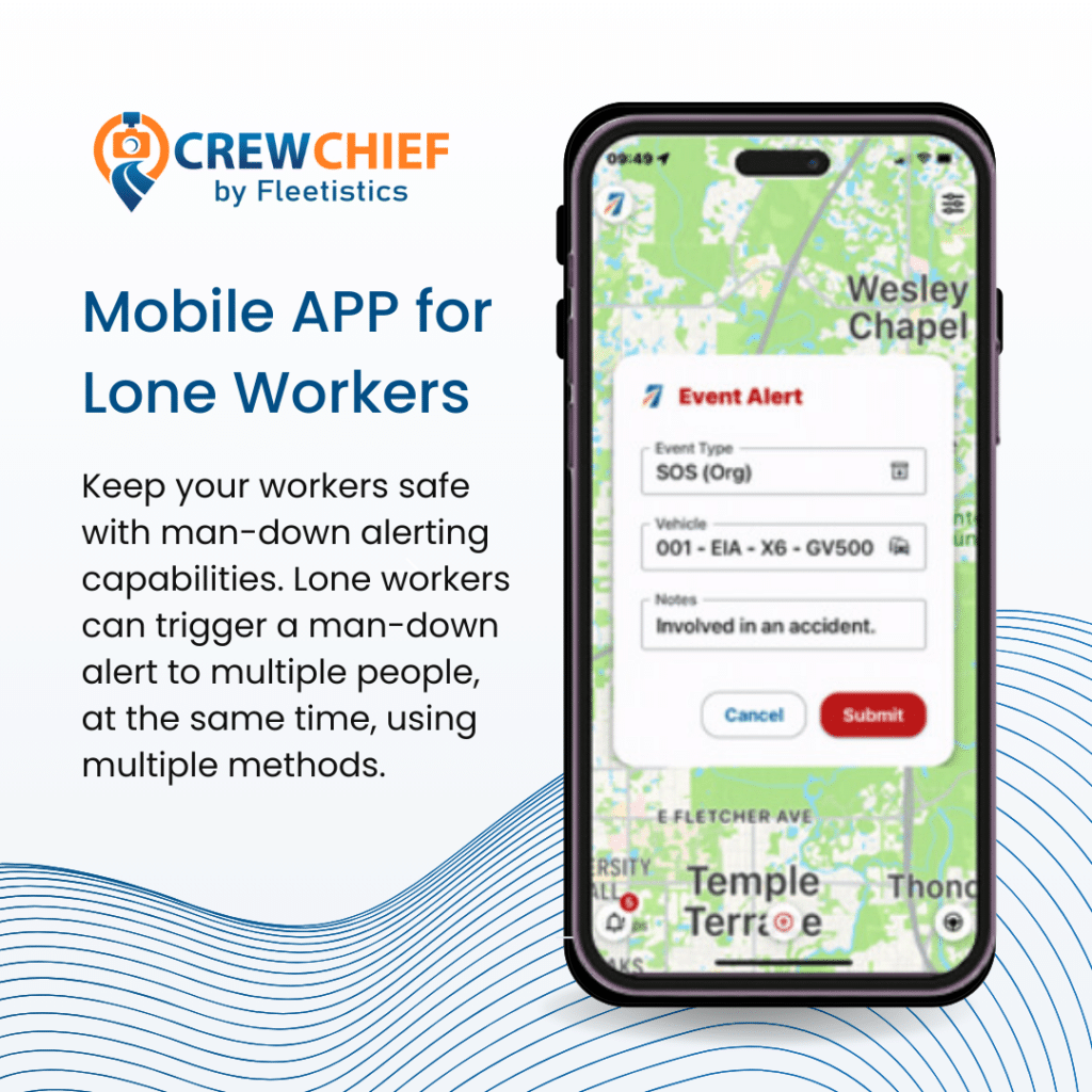
Organizationally, designate a disaster manager. This position should be the single point of contact for all fleet preparation for hurricanes and communications. The disaster manager and their team should have a reliable communication system that isn’t dependent on power from the electrical grid. In the case of cell phones, backup power sources for charging should be available. In many situations the fleet vehicles can be a source of power to recharge communication devices. Cell phones and tablets provide access to your GPS system. Since GPS systems are hosted, they will be available to internet connected devices. Many GPS systems offer a mobile app. Most of the mobile apps do not provide access to all features of the system. Using a tablet provides a more convenient way to access the full GPS system by using a browser.
After The Hurricane
In the aftermath of a hurricane, the security of vehicles and equipment is paramount. Theft is a major concern after the hurricane passes. A GPS system provides the ability to create zones or geofences. This provides the ability to designate and monitor approved locations for vehicles and equipment. GPS systems can provide notification when vehicles or other device equipped assets are removed from designated areas.

Many organizations use multiple GPS systems. Vehicles are managed by systems that specialize in reporting vehicle specific data. Other systems specialize in tracking trailers and other equipment. Fleetistics provides a unique tool for monitoring multiple systems in a single window. During and after a disaster, switching between multiple systems is an inconvenience and it uses more power through maintaining multiple connections to servers. Fleetistics offers a system that displays vehicles, equipment, and other assets in a single window. This simplifies monitoring all assets as well as conserves power.
In the aftermath of a hurricane, local, state, and federal government resources need time to deploy. After the hurricane, most government agencies, state organizations and individuals should prepare to be totally self-sufficient for at least 3 days. Crowd sourcing apps like the PubSafe app from Aftermath Data can be a great help both with internal and external disaster related communications.
Disaster planning can mitigate many of the challenges during and after the hurricane. Stockpile as much fuel and consumables as possible. Designate a disaster manager. Plan for the location of vehicles and other assets. Use the tools provided by your GPS system to monitor asset location as well as fuel levels and other parameters reported by the system.


")